At-a-Glance Schedule – 8 Week
Eight Weeks of Scientific Discovery, Mapmaking, and Real-world Problem Solving!
The 8-week Fall/Spring program meets Saturday from 9:00AM – Noon each day.
 Week One – February 29
Space and Place
On the first day of the program, students will begin working with maps of all types and learn about their local community through maps. They will also see how maps are important and useful for solving everyday problems across a wide range of areas––from public health to natural resources and the environment.
 Week Two – March 7
Tools and Tech
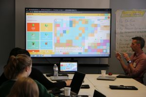
During the second week, students will begin working with different data collection tools through smartphones and other mobile devices and will learn about the different types of data that can be added to maps. They will also learn how to use the internet to collect and view data. Each student will contribute, in real time, to an active Citizen Science project!
 Week Three – March 21
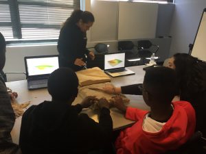
Modeling and Geovisualization
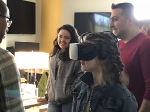
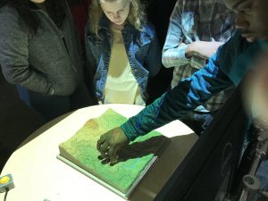
This week, students will take an exciting field trip to the NC State University Geovisualization Laboratory, where they will engage in numerous hands-on activities with cutting-edge mapping technologies, including Tangible Landscape (pictured at left), virtual reality using Oculus Rift, drones, and the Mapping Sandbox. Students will also get to hear from NC State students and scientists and learn how these researchers use geospatial science every day.
 Week Four – March 28
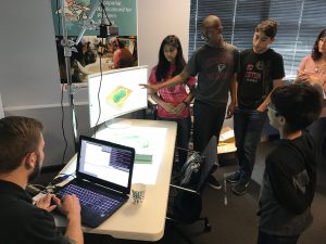
Scientific and Professional Discovery
Building on the field trip the previous week, students will begin working in groups with their own Tangible Landscape models or WebGIS systems to explore project ideas. Students will also hear from a panel of Geospatial Professionals about their careers and their educational path to doing what they do!
 Week Five – April 4
Mapmaking
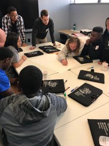
Students will compete in exciting games that teach them the ins and outs of what makes a “good map.” Students will also learn how they can display data they find and how to make presentation-style posters for the projects they develop for the remainder of the program.
Weeks Six and Seven – April 18 and 25
Solving Problems in Your Community
Over the course of two weeks, students will work together and with their program mentors to collect data, build models of their environment, and create maps to analyze an issue of their choosing relevant to them and their communities. For example, students might map access to parks, find out where their drinking water comes from, or explore demographics. The only limits are data availability and students’ imaginations!
 Week Eight – May 2
Mapping Competition Fair!
Parents, friends, and mentors are invited for an exciting morning of poster presentations and awards to conclude the GAPS program. Students can win up to $250 in awards for their project.